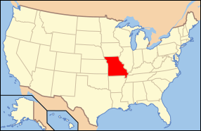
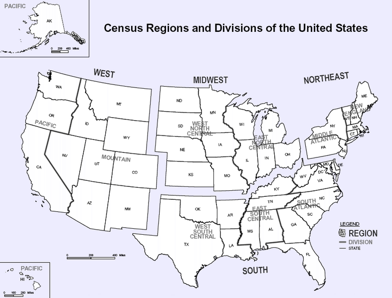
yeah Missouri is in Central USA but more likely in midwestern region of USA.
Missouri
From Wikipedia, the free encyclopedia
Jump to:
navigation,
search
This article is about the U.S. state. For the river, see
Missouri River. For all other uses, see
Missouri (disambiguation).
State of Missouri
 Flag of MissouriSealNickname(s): The Show Me State
Motto(s): Salus populi suprema lex estoBefore Statehood Known as
The
Missouri Territory Official language(s)EnglishCapitalJefferson CityLargest cityKansas CityLargest metro areaSt Louis[1]Area Ranked 21st
 - Total69,709
sq mi
(180,693
km²) - Width240 miles (385
km) - Length300 miles (480 km) - % water1.16 - Latitude36° N to 40° 37′ N - Longitude89° 6′ W to 95° 46′ W
Population Ranked 18th - Total5,817,211 -
Density80.27/sq mi
31/km² (27th) -
Median income $37,934 (31st)
Elevation - Highest point
Taum Sauk Mountain[2]
1,772 ft (540 m) - Mean800 ft (240 m) - Lowest point
Saint Francis River[2]
230 ft (70 m)
Admission to Union August 10,
1821 (24th)
GovernorMatt Blunt (R)
U.S. SenatorsKit Bond (R)
Claire McCaskill (D)
Congressional DelegationListTime zoneCentral :
UTC-6/
-5AbbreviationsMO US-MOWeb sitewww.mo.govMissouri (
pronounced /mɪˈzʊri/ or
/mɪˈzʊrə/) is a
state in the
Midwestern region of the
United States[3] bordered by
Iowa,
Illinois,
Kentucky,
Tennessee,
Arkansas,
Oklahoma,
Kansas and
Nebraska. Missouri is the eighteenth most populous state. It comprises
114 counties and one
independent city. Missouri's capital is
Jefferson City. The largest city is
Kansas City, and the four largest
urban areas are, in descending order,
St. Louis,
Kansas City,
Springfield, and
Columbia.
[4] Missouri was originally purchased from
France as part of the
Louisiana Purchase and part of the
Missouri Territory was admitted into the union as the 24th state in
1821.
Geography
Main article: Geography of Missouri
Missouri's borders physically touch a total of eight different states, as does its neighbor, Tennessee. No state in the U.S. touches more than eight states. Missouri is bounded on the north by
Iowa; on the east, across the Mississippi River, by
Illinois,
Kentucky, and
Tennessee; on the south by
Arkansas; and on the west by
Oklahoma,
Kansas, and
Nebraska (the latter across the Missouri River.) The two largest Missouri rivers are the
Mississippi, which defines the eastern boundary of the state, and the
Missouri, that flows west to east through the state, connecting the two largest cities, Kansas City and St. Louis.
Although today the state is usually considered part of the
Midwest,
[9][10] historically Missouri was sometimes considered a
Southern state,
[11], chiefly because of the settlement of migrants from the South and its status as a slave state before the Civil War. The counties that made up "Little Dixie" were those along the Missouri River in the center of the state, settled by Southern migrants who held the greatest concentration of slaves.
Residents of cities farther north and the state's large metropolitan areas, including those where most of the state's population resides (
Kansas City,
St. Louis,
Columbia), typically consider themselves Midwestern. In rural areas and cities farther south, such as (
Cape Girardeau,
Poplar Bluff,
Springfield, and
Sikeston), people typically consider themselves more Southern.
Missouri - Wikipedia, the free encyclopedia !!
!!


 , It's not Iowa, its Ohio.
 *Runs for the hills!


